Superior Hiking Trail: 3 Day Itinerary
The Superior Hiking Trail 3 Day Itinerary
The legendary Superior Hiking Trail runs 300+ miles north and south along the coast of Minnesota’s Lake Superior. If you planned to hike the entire route, it would take you anywhere from 2-4 weeks.
However if you’re looking for a great introduction to the trail or a route you can do over a single weekend, here is our complete Superior Hiking Trail 3 Day itinerary!

We started at Oberg Mountain and ended at Caribou Trail. Here’s everything you need to know so you can plan your own adventure along this route of the SHT.
Ask me any questions in the comments below!
TO JOIN SHT MY GROUP TRIP FOR 2024, SIGN UP HERE!
And check out the highlights from 2021.

Watch a recap of this exact itinerary here:

If you’re looking for a great hotel before your hike, I highly suggest Mountain Inn. It’s only a few minutes from the Oberg Trailhead. The staff is amazing and they have a great outdoor area with a grill, campfire, picnic tables, hammocks and more!
Day 1: Start at Oberg Mountain
You can park your car overnight at the Oberg Mountain Trailhead. There is an outhouse there but no water source. So fill up your water bottle & camelback before you arrive!
On busy weekends the parking lot may be quite full. We arrived around 9:30am on a Friday and found spots. However Saturdays in the middle of the day might be harder!

10am: Hike the Oberg Loop Spur Trail
Set off following the Superior Hiking Trail signs and do not miss the Oberg Loop on this route! It is one of the most scenic loops in the entire itinerary. It’s an additional 2.6 miles but definitely worth it.
When our trip was done, I hiked this spur trail again before leaving for the weekend because it was SO GOOD.


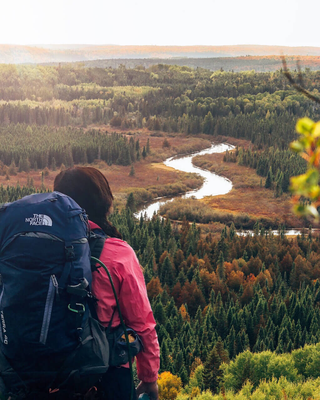
This route is popular because it gives incredible views over Lake Superior and beyond.
During the fall, the colors here are insane. There will be a lot of families and day hikers on this route but once you finish this loop, you can head onto the official Superior Hiking Trail and start heading north towards where you will be camping.

11:30am: Hike the 6.4 miles north towards Mystery Mountain
Enjoy the day, it’s a beautiful hike! During the fall you will walk under canopies of bright yellow, orange and red tree tops.
The trail is interesting, challenging and fun.
Keep following the blue paint on the trees and don’t be afraid to ask other hikers if you feel you need clarification on which way the trail continues.
Fortunately the trail only runs north and south. But keep an eye on where you’re going so you don’t accidentally start off on a spur trail you didn’t intend to hike.
Overall, the Superior Hiking Trail is relatively easy to follow. But if you have a compass (and you should since it’s part of the 10 essentials!) you’ll be able to double check that you’re traveling north.

Camp at the Mystery Mountain campsite
We arrived at camp around 4:00pm. This gave us plenty of time to set up our tents, walk to the small water source to purify more drinking water and cook dinner before it got dark.

The campsites are communal and need no reservations or permits. They are totally free. How great is that?!
It’s a social atmosphere though so plan to share the fire pit with other thru-hikers.


Change out of your hiking shoes (helloooooo comfy camp shoes!) and get your warm clothes on for the night.
Remember to set your bear hang far enough away from camp. Unfortunately, the trees at Mystery Mountain aren’t ideal for a bear hang. We struggled to find a branch that was the correct height and distance from the tree base. The people in our group with bear canisters had an easier time storing food at this SHT campsite. I suggest walking down the path as if you are continuing on the trail, you’ll have better luck finding a tree that way.
There is an outdoor latrine here but it is VERY basic. In fact, there is no walls offering any sort of privacy and it happens to be within view of the communal fire pit. One thru-hiker at our camp hung an REI tarp to give the bathroom some privacy but otherwise plan to do your business in the woods or once it gets dark.

The water source will require you to continue along the SHT for another half mile to a small creek/pond. Always treat your water in the backcountry or you could wind up seriously ill. I used tablets but many of the other girls on my trip used filter systems.
Total distance for Day 1: 9 miles
Day 2: Hike Past Poplar River &
Scenic Overlooks
If you follow our itinerary, you’ll have about 6 miles to hike on your second day.
That is provided that you don’t get turned around at Glove Overlook like we did.
The trail leads out to a beautiful scenic overlook where we had lunch. Half our group continued on the correct path but the other half ventured back south down the SHT beuase the two pathways are side by side. Whoops!


When we eventually caught back up with our group and met others at the campsite, we learned that two other groups at camp made the EXACT same mistake at Glove Overlook. It added an extra two miles to our hike which made us feel nervous when we were running low on water. So the two lessons we learned were this:
1. Always have more water than you think you need
2. When straying off the trail for a scenic overlook, triple check that you’ve gotten back on the correct path and are still heading in the right direction. It sounds silly but it’s an easy mistake to make when hiking and chatting with others.
We were never “lost” so to speak because the trail only runs north and south. It simply added to our time when we didn’t realize we were backtracking. So consult your compass occasionally and if you follow this itinerary, make note of that sneaky Glove Overlook!
Hike alongside the Poplar River
Not far after Glove Overlook, you’ll hit the beautiful Poplar River. This is a great place to fill up on water. It’s a clear, running water source making it very ideal!
After that you’ll hike alongside the river for awhile and begin winding your way up.


See the Poplar River from above
Eventually you will come upon a spectacular view showcasing the Poplar River from above, showing just how far you’ve hiked! It’s a spectacular view.
From there, it’s not much further to camp.


Camp at Lake Agnes
There are actually two campsites here: east and west. We camped at Lake Agnes West which is up a long set up of stairs. It’s actually warmer in the fall because you’re away from the shore.
Lake Agnes East has beautiful lake views but you are right near the water which can be good and bad. You won’t have to walk far to purify your water source but the wind coming off the water can be chilly at night.
Both are great campsites though, the views are unreal! It will just depend where there is space to set up camp.
Important to note: Campers must make room at the campsites since there are no reservations and it would be unkind and unsafe to refuse to make room at camp and force others to continue to the next camp especially if it were getting dark.
You may be alone at a campsite but most likely there will be other people around.
We had 19 people at our Lake Agnes West campsite and we had a fantastic time swapping stories, getting to know one another and hanging out at the fire!


Total distance for Day 2: 6 miles
Day 3: White Sky Rock Spur Trail &
Shuttle Back to Oberg Mountain
Due to shuttle availability, we ended our last day around 1pm. Our third day was shortest with the least hiking but some of the best views!
We left camp around 9am and enjoyed time by the lake before continuing on. If you are planning to end at Caribou Trail CR 4, then you will come to a spot along Lake Agnes where you can continue along the SHT or turn upwards away from the lake towards a sign reading “Caribou Parking Lot .9 miles” -follow this sign!

You’ll go down some fun tree trunk staircases and big mossy rocks along the way to the White Sky Spur Trail.

Hike the White Sky Rock Spur Trail
This fairly strenuous but short spur trail packs MAJOR punch. It’s a mostly uphill .6 mile climb but the views at the top are spectacular. Especially in the fall! This little spur trail is a great place to hang out until the arrival of your shuttle.


After we enjoyed lunch from the top of the White Sky Rock, we began the descent down to the parking lot for the shuttle we had prescheduled.
We were picked up at Caribou Trail and brought back to Oberg Mountain where we left our cars.
*Our 3rd day was relatively short but you could continue on to Cascade River for pick up if you wanted another full day of hiking.
You can reserve a shuttle back to your car here.

If you use this shuttle service (there are a few options) just know reservations must be placed at least four days in advance.
If you are looking to celebrate after, I suggest going to ride the Lutsen Gondola (although it’s a little pricey!) and have lunch at the restaurant up on the peak. Don’t miss the viewing platform to the right when you step off the Gondola at the top. The colors here are always amazing.

Unsure of everything you need to pack? You can find my 3 day packing list here.


For more information on the Superior Hiking Trail, check out the official website and consider becoming a member!

Thank you to Syndol for arranging this hiking weekend and preparing our itinerary! Like & follow her Facebook page, Enchanted Wanderer for more hiking tips, tricks & updates 🙂

Read: 8 AMAZING REASONS TO TRY BACKPACKING IN MINNESOTA
Save “Superior Hiking Trail: 3 Day Itinerary” on Pinterest for later!


Shop My Superior Hiking Trail Essentials
Shop all my personal recommendations for backpacking on my Amazon Storefront!

Looking for more fun things to do in Minnesota?


Thanks for sharing this!! Super helpful!
Hi Kyle! Thanks for reading 🙂 I’m glad you found it helpful!! Best of luck on your SHT adventures!
Were you sore?? I want to do this but I’m afraid I can’t hike 20+ miles…
Yes but not as sore as I thought I would be!! I did the trip coming out of quarantine so I wasn’t in very good shape haha. I think I experienced some kind of hiker’s high because it was INCREDIBLE. Slightly sore the next day but honestly, not too bad! Just have good shoes that don’t give you blisters and you’ll be set 🙂 You should do it!!
Hi, thanks for the great itinerary! Never done this so it was helpful. Wondering how do you shower/bathe on the trail? Or do you not lol?
Yes of course!! I’m so glad you found it helpful 🙂
Great questions! For a short 3 day trip, we just would wipe ourselves clean with some compostable wet wipes before changing into our camping clothes or “pajamas”. A few brave souls jumped in Lake Superior despite it being very cold! For long hikes, you can shower at the state parks as you pass through them or when you get your resupply pick up in town. But for 3 days, just shower before you go and embrace it hah!
Is there any stretches you would recommend most for a 2 day hike with 1 overnight on the superior hiking trail?